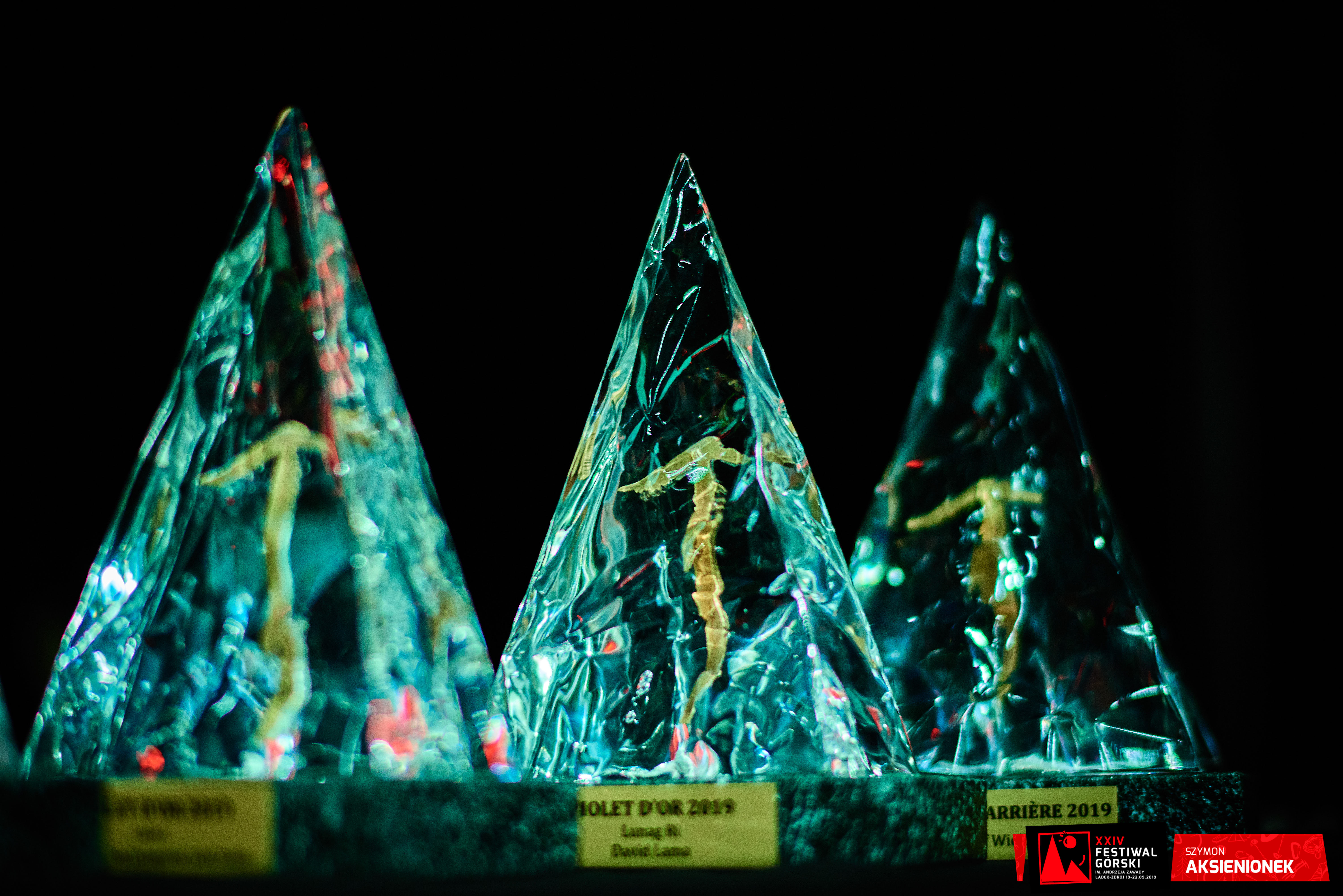
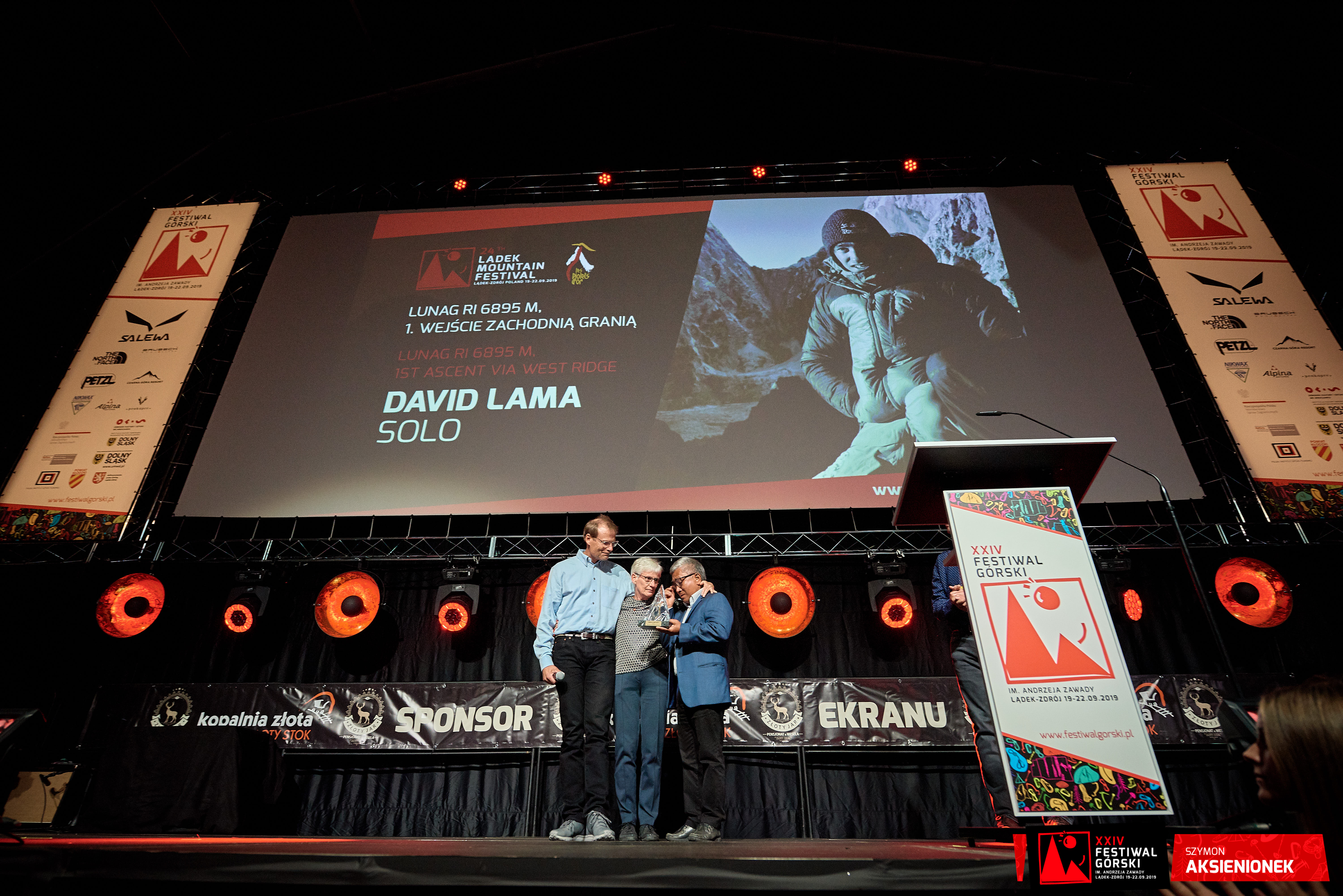
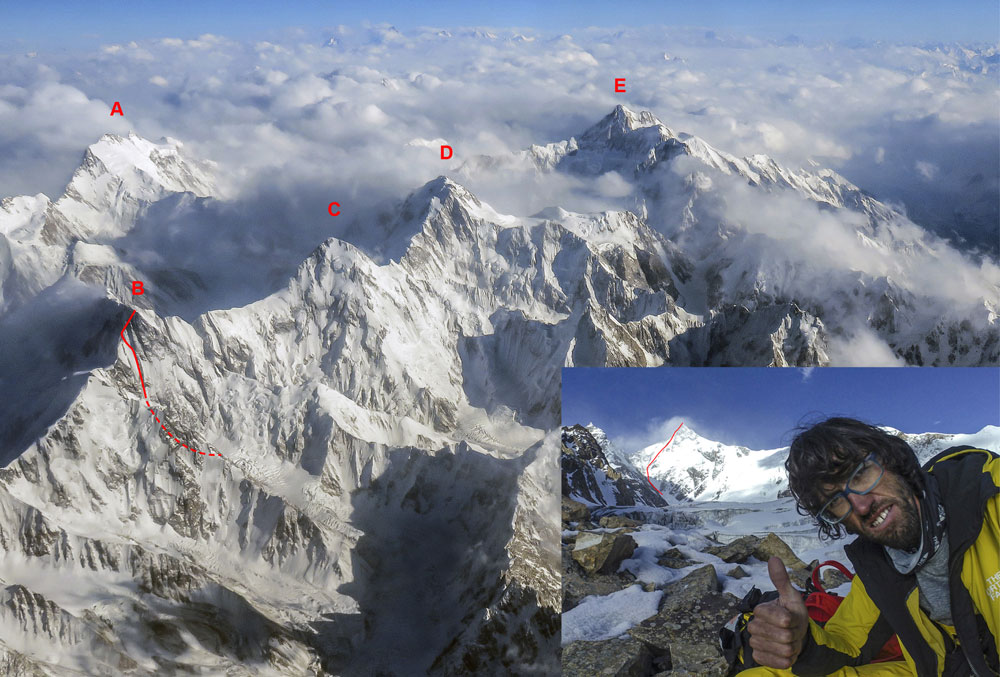
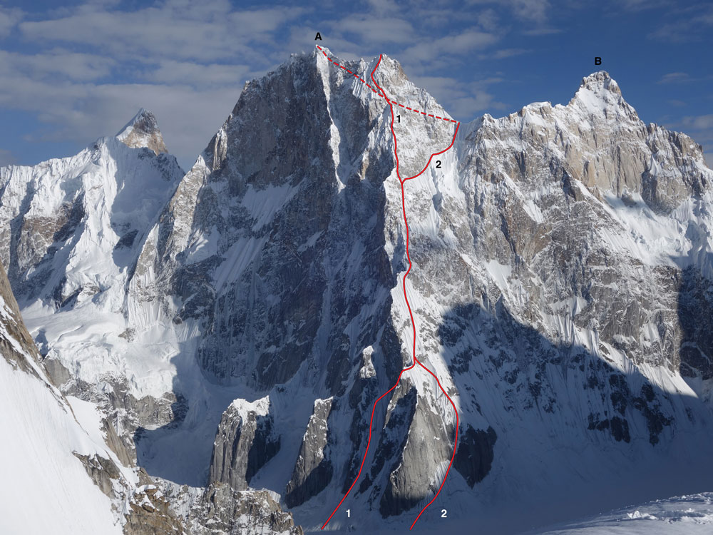
Piolets d'Or - 2019 Honoured ascents
  • Piolets d'Or 2019 | 23rd September 2019 | ©Szymon Aksienionek

  • Piolets d'Or 2019 | 23rd September 2019 | ©Michal Zlotowski

  • Piolets d'Or 2019 | 23rd September 2019 | ©Lucyna Lewandowska

  • Piolets d'Or 2019 | 23rd September 2019 | ©Michal Zlotowski

  • Piolets d'Or 2019 | 23rd September 2019 | ©Michal Zlotowski

  • Piolets d'Or 2019 | 23rd September 2019 | ©Szymon Aksienionek

  • Piolets d'Or 2019 | 23rd September 2019 | ©Szymon Aksienionek

  • Piolets d'Or 2019 | 23rd September 2019 | ©Szymon Aksienionek

  • Piolets d'Or 2019 | 23rd September 2019 | ©Szymon Aksienionek

  • Piolets d'Or 2019 | 23rd September 2019 | ©Michal Zlotowski

2019 Honoured ascents

Lunag Ri (6,895M)

Lunag Ri from the southwest.
(A) Main summit (6,895m).
(B) Southeast top
(1) Line of Anker-Lama attempts in 2015 and 2016.
(2) Line of Lama’s solo ascents.
(H1) High point with Anker in 2016.
(H2) High point of 2015 attempt and 2016 solo attempt.
©David Lama/American Alpine Journal

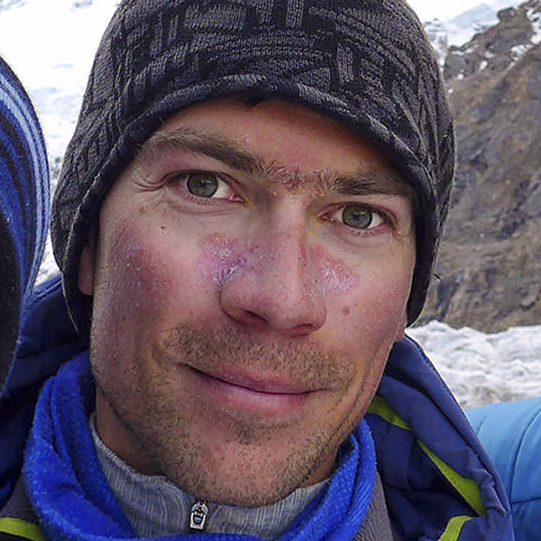
FIRST ASCENT VIA WEST RIDGE1,500M, 90°,
DAVID LAMA (AUSTRIA), SOLO, OCTOBER 23-25

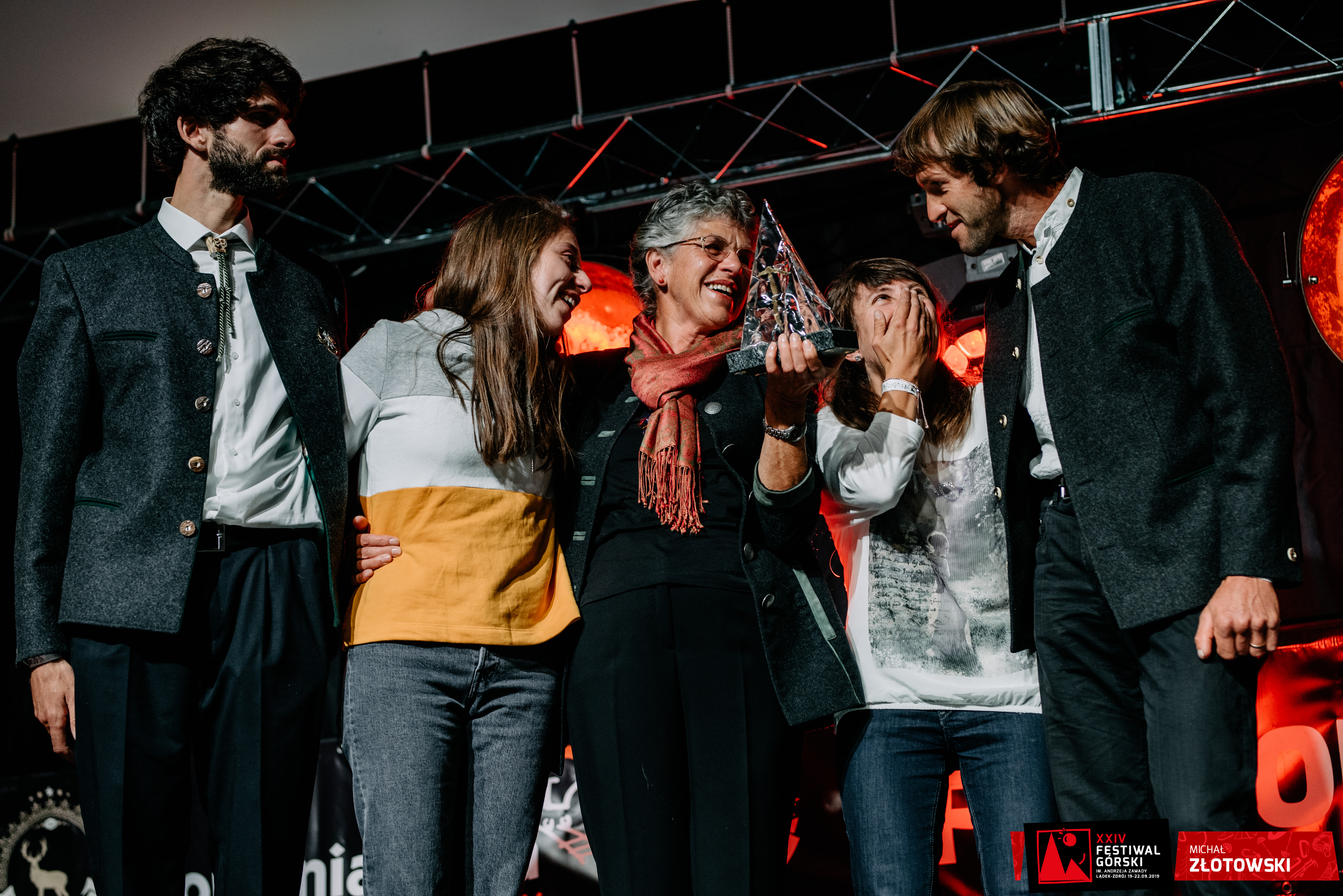
Lunag  Ri  is  the  culminating  point  of  the  Rolwaling's  Lunag  Massif,  which  straddles  the  Nepal-Tibet  border.  Before  2018  it  was  one  of  the  highest  unclimbed peaks in Nepal and there had been at least four serious attempts to reach its lofty summit. An attempt from the southeast, and another from the north, both finished on a subsidiary southeast top. In 2015 Conrad Anker and  David  Lama  reached  a  point  on  the  west  ridge  around  300m  below  the  summit,  finding  the  ridge  more  complex  and  difficult  than  expected.  They returned in 2016, only for Anker to be evacuated by helicopter after suffering a  stroke.  Lama  subsequently  made  a  bold  solo  attempt,  surpassing  his  previous high point by around 50m.In 2018, when Anker confirmed he would no longer go on this sort of expedi-tion, Lama decided to decline other offers from strong partners and to go it alone. In the intense cold of late October, the Austrian climbed difficult mixed terrain, ice and snow, with two bivouacs, to reach the crux technical climbing on the steep headwall. Surmounting this, he made an airy traverse on to the spectacular  diving-board  summit.  Lama  descended  by  rappel,  mostly  along  the  line  of  his  route.  It  was  a  climb  that  would  remain  "engraved  in  my memory for the exposure, the difficulty, the cold and the loneliness, and for a successful conclusion to a personal project".

Luphgar Sar West (7,157M)

The western end of the Hispar Muztagh with :
(A) Distaghil Sar (7,885m),
(B) Lupghar Sar West (7,175m), showing the 2018 route on the west face,
(C) Momhil Sar (7,414m),
(D) Trivor (7,728m) and
(E) Khunyang Chhish (7,852m).
Hansjörg Auer on the Baltbar Glacier, and his line on the west face of Lupghar Sar West.
©Hansjörg Auer/American Alpine Journal

WEST FACE 1,000M, M4 55°,
HANSJÖRG AUER (AUSTRIA), SOLO - IN A DAY, JULY 7

The rarely-attempted Lupghar Sar massif in the Hispar Muztagh of the Western Karakoram comprises three peaks on a high east-west summit ridge. The west summit was first climbed in 1979 by Germans via the southwest ridge, which featured dangerously rotten rock - a characteristic of this summit. It was repeated the same year, and again in 1980, by Japanese, the first of these expeditions continuing east for more than one and a half kilometres along the sharp ridge to the Central (Main) summit. These were
full scale sieges and neither the West or Central peaks were seriously attempted again until 2018.

After extensive acclimatization and scouting of both face and complex approach, Hansjörg Auer left base camp and navigated the wild Baltbar Glacier to a bivouac at 6,200m below the left side of the west face of Lupghar Sar West. The next day he made a rapid ascent of the west face to reach the steep upper section of the northwest ridge at 6,900m. Although he had planned a second bivouac, he decided to cache his gear and head for the top. Very loose mixed terrain and a highly exposed, narrow, corniced crest led to the highest point. Auer managed to descend to base camp by the evening of the same day. Although the technicalities were not high, this was bold, committing and precarious climbing, with a taxing descent of the same route, completely alone at high altitude and in a remarkably fast time.

Latok I (7,145M)

Seen from the north,
(A) Latok I (7,145m) and (B) Latok II (7,108m).
(1) The 2018 Russian attempt on the north ridge, reaching the summit ridge at approximately 7,050m.
(2) Anglo-Slovenian route to make the second ascent of Latok I, passing through the west col to finish via the southern slopes.
©Sergey Glazunov/American Alpine Journal

NORTH RIDGE/FACE AND SOUTH FACE 2,500M, ED+,
ALEŠ ČESEN - LUKA STRAŽAR (SLOVENIA) - TOM LIVINGSTONE (U.K.), AUGUST 5–9

In 1978 four Americans attempted the "Walker Spur of the Karakoram", the north ridge of Latok I from the Choktoi Glacier. Jim Donini, Michael Kennedy, George and Jeff Lowe spent 21 days climbing over 100 pitches and had probably surmounted all the difficulties, when a combination of wind, cold and Jeff Lowe’s rapidly deteriorating condition due to altitude sickness forced a retreat. It remains one of the finest and most notable near misses in the history of alpinism. Despite literally dozens of subsequent attempts over the next 40 years, no one came close to reaching their high point of nearly 7,000m. The first and to date only ascent of the mountain was made in 1979, when a Japanese team reached the summit from the south.

Tom Livingstone met Luka Stražar at an international winter gathering in Scotland. Together with Aleš Česen they travelled to the north side of Latok I, where Česen confided, "we think there is a better way to the summit than the full north ridge". American Josh Wharton, who travelled to the Choktoi four times to attempt the north ridge, envisaged a line that would climb the right flank of the ridge, then slant up to the (west) col between Latok I and II. From there his proposed route crossed onto the south side of the mountain, where easier terrain would lead to the top. This was the route eventually followed by the Anglo-Slovenian trio, who climbed generally good ice runnels and névé on the right side of the ridge to around 6,400m, at which point they angled up right to reach the west col at 6,700m. From there they followed south-facing snow slopes in generally stormy weather to the summit, which they reached on their fifth day. Descending approximately the same line, the team regained base camp three days later, having made only the second ascent of this prestigious mountain in the Panmah Muztagh, and the first from the north.

2023 Organizers